


PECK - T 1 Voting District, Langlade County, Wisconsin
About
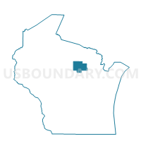
Outline

Summary
| Unique Area Identifier | 694590 |
| Name | PECK - T 1 Voting District |
| County | Langlade County |
| State | Wisconsin |
| Area (square miles) | 37.22 |
| Land Area (square miles) | 37.04 |
| Water Area (square miles) | 0.18 |
| % of Land Area | 99.52 |
| % of Water Area | 0.48 |
| Latitude of the Internal Point | 45.24217800 |
| Longtitude of the Internal Point | -89.24484130 |
Maps


Graphs
Select a template below for downloading or customizing gragh for PECK - T 1 Voting District, Langlade County, Wisconsin


Neighbors
Neighoring Voting District (by Name) Neighboring Voting District on the Map
- ACKLEY - T 1 Voting District, Langlade County, WI
- ANTIGO - T 1 Voting District, Langlade County, WI
- NEVA - T 1 Voting District, Langlade County, WI
- SUMMIT - T 1 Voting District, Langlade County, WI
- UPHAM - T 1 Voting District, Langlade County, WI
- VILAS - T 1 Voting District, Langlade County, WI
Top 10 Neighboring County Subdivision (by Population) Neighboring County Subdivision on the Map
- Antigo town, Langlade County, WI (1,412)
- Neva town, Langlade County, WI (902)
- Upham town, Langlade County, WI (676)
- Ackley town, Langlade County, WI (524)
- Peck town, Langlade County, WI (349)
- Vilas town, Langlade County, WI (233)
- Summit town, Langlade County, WI (163)